
ARTICLE AD BOX
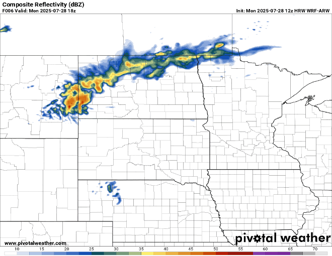
A derecho is possible across central and southern Minnesota late Monday into Monday night, bringing a significant wind threat. Wind gusts over 75 mph are possible, along with heavy rain and embedded tornadoes within the line.
What is a derecho?
According to the National Weather Service, a derecho is a widespread, long-lived windstorm associated with a fast-moving group of severe thunderstorms, typically forming in a line known as a squall line. These storms can produce straight-line winds that are as damaging as tornadoes and Category 1 hurricanes, but without the rotating structure.
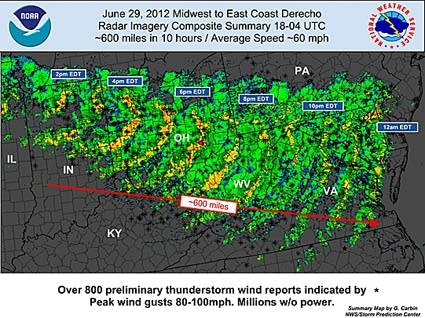
Derechos can last for hours and span hundreds of miles. For example, one derecho event stretched over 600 miles and lasted about 10 hours.
Why are derechos dangerous?
The sheer size and duration of these events pose a significant risk to people and property. Unlike tornadoes, which are more localized, derechos can impact entire regions and span multiple states.
These storms can also move very quickly — at speeds of 50 to 75 mph — and produce straight-line wind gusts exceeding 75 mph. In some cases, wind gusts have been recorded at up to 100 mph. Heavy rains and embedded tornadoes within the storm line are also possible.
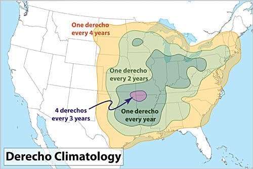
A derecho event is not as uncommon as you might think. Areas near central Minnesota and the Twin Cities average about one derecho per year.
Strong storms headed for Minnesota
Ongoing storms in the Dakotas will continue tracking east on Monday, bringing the risk of significant wind damage, large hail and isolated tornadoes by late Monday afternoon into Monday evening.
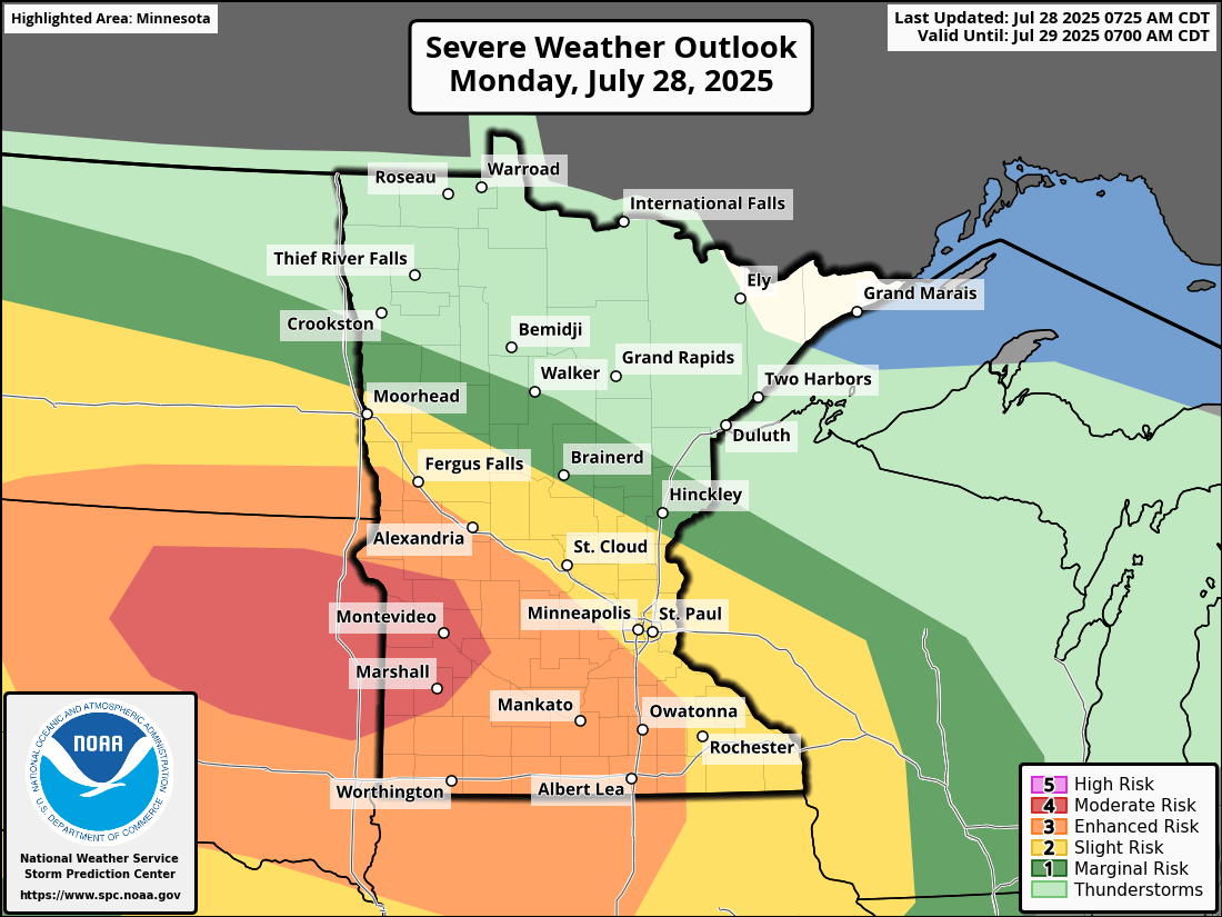
There is a moderate risk (level 4 of 5) for severe weather in southwestern and west-central Minnesota. An enhanced risk (level 3 of 5) and a slight risk (level 2 of 5) are highlighted for most of southern Minnesota.


 English (US) ·